
Key Takeaways
- Best months: June and September for high routes, May and October for mid-level trails, winter for valley walks only.
- Best first hike: Los Cahorros de Monachil, a half-day gorge walk with hanging bridges and no mountain skills required.
- Biggest day: Mulhacen, mainland Spain’s high point at 3,479 m (11,414 ft), reached from the Capileira side.
- Base yourself in Granada. Pradollano serves high trailheads, Monachil serves Los Cahorros, Guejar Sierra serves the valley paths.
- Difficulty is about altitude, not distance. A route that reads as moderate can feel hard above 2,500 m (8,200 ft).
- Connectivity: download offline maps before you leave town, and set up a Telekonek Spain eSIM for forecasts, transport updates and emergency contact.
What Makes Hiking in the Sierra Nevada, Spain Worth Your Time
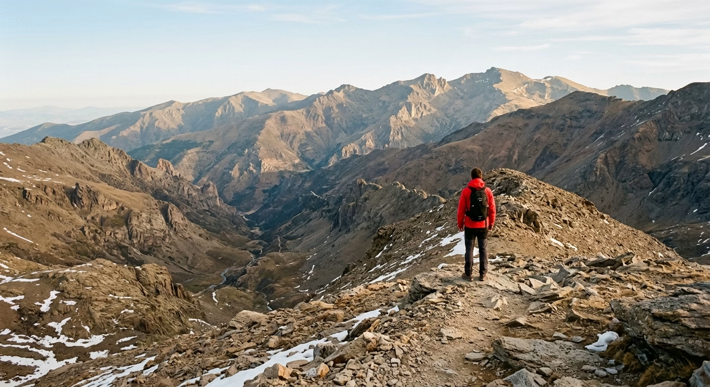
For hiking in the Sierra Nevada, Spain, you get a rare mix: high mountain drama, Mediterranean light, and a range that rises almost directly behind Granada. One day can take you from whitewashed villages and chestnut groves to wide, empty ridges above the tree line. On clear mornings, the views stretch across Andalusia, and you may even spot the distant Mediterranean coast.
The headline peak is Mulhacen, the highest mountain in mainland Spain at 3,479 m (11,414 ft). You do not need to climb it to feel the range’s scale. Even lower walks around Monachil, Guejar Sierra, and the Alpujarras bring you into deep river gorges, pine woods, old irrigation channels, and slopes scattered with tiny mountain flowers.
The range is also one of Europe’s most important high-mountain nature areas, protected as a national park since 1999. You can hike through habitats that change quickly with altitude. Lower paths feel dry and warm, while higher routes are exposed, rocky, and surprisingly alpine. Keep your eyes open for Spanish ibex on crags and ridgelines, and give them space when you meet them close to a trail.
- Big-peak terrain: High routes deliver broad views and a real sense of wilderness without leaving southern Spain.
- Varied landscapes: You can choose waterfalls and gorges, forest walks, remote valleys, or bare summit country.
- Easy Granada pairing: You can combine mountain days with the Alhambra, tapas bars, and a comfortable city base.
- Routes for different abilities: Short riverside walks and demanding all-day ascents sit within the same national park area.
The range rewards hikers who look beyond the ski-resort image. The Sierra Nevada resort area has high, open slopes and useful mountain access, but the quieter villages on the southern side often feel more rooted in rural Andalusia. In places such as Capileira, Pampaneira, and Trevelez, stone paths and water channels give a hike a stronger local character than a straightforward summit push.
Watch out for the altitude. A trail that seems moderate on paper can feel much harder above 2,500 m (8,200 ft), particularly if you have arrived from sea level. Sun, wind, and sudden temperature drops can all appear on the same route. Save offline maps before setting out, but keep live data available for weather changes, transport updates, and emergency contact. Telekonek gives you that practical layer, with eSIM data plans that work in 200+ countries.
Takeaway: Sierra Nevada gives you Spain’s highest mainland mountains, striking wildlife, and radically different landscapes within easy reach of Granada.
Best Trails for Hiking in the Sierra Nevada, Spain
The right route for hiking in the Sierra Nevada, Spain depends on how much elevation, exposure, and travel time you want. You can find an easy river walk near Granada, a full-day summit push, or a high plateau route above the ski area.
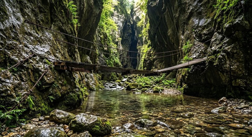
- Los Cahorros de Monachil, easy to moderate. This is the classic first hike for many visitors. The trail follows the Monachil River through a narrow gorge, with hanging bridges, rock overhangs, and short sections where you squeeze beneath cliff walls. It feels adventurous without requiring mountain skills. Watch out for: rocks can be slick after rain, and the narrowest passages become slow when day-trip groups arrive.
- Vereda de la Estrella, moderate. Starting near Guejar Sierra, this long, historic path runs through pine woodland beneath the big north faces of Mulhacen and Alcazaba. You do not need to complete the full route; turn around when your legs or daylight say so. This is a strong choice when you want serious mountain scenery without committing to a summit.
- Hoya de la Mora to Veleta, moderate to hard. This high-altitude outing begins near the Sierra Nevada ski area and heads toward Veleta, one of the range’s most recognizable peaks. The terrain is broad and open, with huge views and far less shade than lower trails. Altitude makes this tougher than the path looks. A walk that feels easy near sea level can leave you breathless above 3,000 m (9,800 ft).
- Mulhacen via the Capileira side, hard. Mulhacen is the mainland Spain high point, and reaching it is a proper mountain day. Expect a long ascent, changing weather, and exposed high ground rather than technical climbing. The reward is the scale: dry southern slopes, deep valleys, and a summit panorama that makes the effort feel earned.
- Laguna de las Yeguas and the high lakes, moderate. These high-country paths offer a gentler alternative to a peak day. You get open slopes, small alpine lakes, and the strange, almost treeless landscape above the forest line. It is a good fit when you want altitude views without the length of Mulhacen.
Do not judge a Sierra Nevada route by distance alone. Sun, wind, loose stone, and thin air can turn a modest hike into a demanding one. Carry an offline map, share your planned turnaround time, and check conditions before leaving your lodging.
Takeaway: Choose Los Cahorros for a fun half-day, Vereda de la Estrella for classic mountain views, and Mulhacen only when you are ready for a long, high-altitude day.
How Difficult Are Sierra Nevada Hikes?
Difficulty here is less about trail distance than elevation, altitude, and exposure. A 10 km (6 mi) walk near Monachil can feel relaxed, while the same distance above 3,000 m (9,800 ft) can leave you breathless. When planning hiking in the Sierra Nevada, Spain, judge each route by its climbing, starting altitude, shade, and how easy it is to turn back.
Beginner: low-valley walks and short gorge routes. Choose trails around Monachil, Guejar Sierra, and the lower Alpujarras villages. Los Cahorros works well when you want a half-day outing with river scenery and a little adventure. The narrow sections and suspension bridges can feel more intimidating than the fitness level suggests.
- Best for: first-time visitors, families with confident older children, and anyone without mountain experience.
- What it feels like: uneven paths, occasional scrambling around rocks, and short climbs rather than long uphill grinds.
- Watch out for: sandals are a bad idea. Wet limestone and polished river rocks can be slippery, even on an easy walk.
Intermediate: sustained climbs, long days, and village-to-ridge routes. This level includes routes where you gain enough height to change the landscape from woodland to open slopes. You need steady legs, a proper lunch break, and enough water for several hours. A route can be technically simple yet still tough when the sun is strong and the trail keeps climbing.
- Best for: regular walkers comfortable with four to seven hours outside.
- What it feels like: long uphill sections, loose stone, exposed sun, and tired knees on the descent.
- Good test: you should be able to walk uphill at a conversational pace while carrying water, food, and a warm layer.
Advanced: high-altitude peaks and Mulhacen-scale objectives. These are full mountain days, not casual sightseeing walks. Thin air makes ordinary effort feel harder, and weather can change fast on open ground. You need route-finding confidence, solid footwear, and the judgment to turn around when wind, cloud, or fatigue builds.
Do not treat a summit plan as fixed because a map shows a clear line. Snow, ice, storms, and seasonal access conditions can change the real difficulty. Download your route before you set out, then use your Telekonek data for forecasts and check-ins while you still have a signal in the valley.
Takeaway: Start in the valleys and move up only when your fitness and mountain judgment match the route, not just its mileage.
The Best Season for Hiking in the Sierra Nevada, Spain
For hiking in the Sierra Nevada, Spain, late May through June and September through October give you the best balance of open trails, comfortable temperatures, and clear mountain days. The catch is altitude: Granada can feel warm while the high ground near Mulhacen is cold, windy, or still snow-covered.
Use the wider seasonal picture in this guide to the best time to visit Spain, then choose your hiking dates around the elevation of your route. Check the mountain forecast from Spain’s national weather agency, AEMET, rather than the city forecast for Granada.
- January and February: Proper winter on high trails. Snow and ice can cover routes above the ski area, while lower walks around Monachil and the Alpujarras may be bright and quiet. Choose low-elevation routes unless you have winter mountain skills.
- March: A changeable month. Valleys begin to green up, but fresh snowstorms are still possible higher up. Expect mud on river paths and large temperature swings between sun and shade.
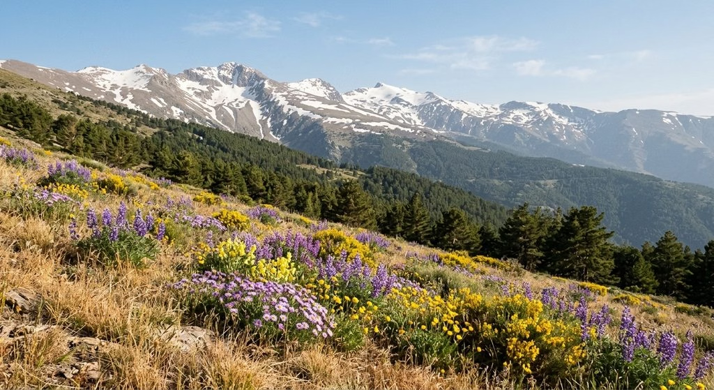
- April: One of the prettiest months for lower slopes, with wildflowers and flowing streams. High passes may remain blocked by snow, so avoid assuming a summit route is open just because Granada feels like spring.
- May: Excellent for mid-level hikes. Flowers are at their best, birds are active, and daytime temperatures are usually pleasant. Snow can linger above roughly 3,000 m (9,800 ft).
- June: Often the strongest all-round month for hiking in the Sierra Nevada. Many high routes become practical, alpine flowers appear, and long daylight gives you more margin for a full-day walk.
- July and August: Best for high, early-start hikes, not hot valley walks. Start near dawn, carry more water than you think you need, and finish before afternoon heat or thunderstorms build.
- September: A standout month. Summer heat eases, skies are often clear, and high trails remain accessible. You may spot Spanish ibex on open slopes in the quieter hours.
- October: Cool, crisp, and usually less crowded. This suits long routes, but daylight shortens fast and the first cold fronts can bring rain, wind, or early snow.
- November and December: Lower village trails work well on settled days. Above the tree line, winter conditions return quickly, with icy patches and strong wind possible.
Watch out for: summer heat is not the only danger. Wind and sudden cloud can make a high ridge feel close to freezing, even after a hot start. Pack a warm layer in every season and take a last forecast check before committing to exposed ground.
Takeaway: Choose June or September for high routes, May or October for mid-level trails, and winter for lower valleys only.
Safety Tips for Hiking in the Sierra Nevada
Treat the mountain forecast as more important than Granada’s weather. Conditions can change quickly once you climb above the villages. A bright, warm morning can turn into strong wind, cold cloud, or poor visibility on exposed ground.
Before leaving, tell someone your exact route, starting point, planned turnaround time, and expected return time. Send a map link or a screenshot, not just “Mulhacen” or “near Monachil”. Several routes share similar names and trailheads, which makes a vague plan useless if you are overdue.
- Set a turnaround time. Turn back when you reach it, even if the summit looks close. Descending steep, loose ground takes longer than most first-time visitors expect.
- Use an offline map. Download your route and save it on your phone before leaving your accommodation. Carry a charged power bank and keep your phone in a warm inner pocket on high routes.
- Carry water before you need it. Do not assume fountains, streams, or mountain refuges will be available. Bring more water than you expect to drink, plus salty snacks and quick calories.
- Watch the terrain, not only the view. Loose stones, wet river rocks, and narrow gorge paths cause more trouble than dramatic summit terrain. Slow down on descents and leave space between hikers.
Your Telekonek connection is useful for loading a last-minute forecast, checking your location, and contacting help. It is not a substitute for an offline map or a shared itinerary. Signal can disappear in ravines and behind ridges, so do not wait until you are lost to open your navigation app.
Give wildlife space. You may see grazing animals, birds of prey, or mountain goats, especially on quieter slopes. Never feed, chase, or photograph animals from close range. Keep dogs under control where allowed, and step away calmly if animals block a narrow path. Watch out for livestock guardian dogs near herds; do not run, shout, or get between a dog and the animals it is protecting.
If you are injured, lost, or caught in dangerous weather, move to a safer visible spot if you can, then stop. In Spain, call 112 for emergency help. State that you are hiking in Sierra Nevada, then give your map coordinates, trail name, direction of travel, clothing colors, group size, and any medical issue. Preserve battery by lowering screen brightness and avoiding repeated calls unless instructed otherwise.
Takeaway: Download your route, share a precise plan, carry extra water and power, and call 112 early if a mountain problem is getting worse.
What to Pack for a Day of Hiking in the Sierra Nevada, Spain
Pack for two climates, not one. Granada can be warm at breakfast, while a ridge near Mulhacen can bring cold wind, harsh sun, and a fast temperature drop. Your gear should handle both without making your pack too heavy.
- Trail shoes or hiking boots: Choose grippy soles for loose stones, dusty paths, and slick rock around Los Cahorros. Low-cut trail shoes work on dry valley routes. Use ankle-supporting boots for long, rocky climbs or when carrying more water.
- Light layers: Wear a moisture-wicking T-shirt, then pack a fleece or light insulated layer. Add a windproof, waterproof shell even on a clear day. Avoid cotton, which stays damp and cold after sweat or rain.
- Sun protection: Bring SPF 30+ sunscreen, sunglasses, and a cap with a brim. High trails have little shade, and reflected sun from pale rock can be intense.
- Water capacity: Carry at least 2 liters for a shorter low-level walk. Bring 3 liters or more for exposed summer routes, long climbs, or routes without a reliable refill point.
- Food with salt and staying power: Pack a sandwich or wrap, nuts, fruit, and a salty snack such as crackers. Add one quick-energy item for the final climb or an unexpected delay.
Your small safety kit matters more here than fancy hiking gadgets. Carry a paper map or downloaded offline map, a charged phone, a compact power bank, headlamp, whistle, blister pads, pain relief, and a basic bandage kit. Trekking poles are especially useful on the long, loose descents that punish your knees more than the climb.
Keep your phone in airplane mode when you do not need it, then switch on data for a map check or a message. That is enough to update a contact, check a changing forecast, or find transport after a route change, without draining the battery you may need later.
Watch out for one common mistake: do not leave your warm layer in the car because the village feels hot. Wind at higher elevations can make a rest stop feel chilly within minutes, especially after you stop sweating.
Takeaway: Use a 15 to 25 liter daypack with water, layers, sun protection, offline navigation, food, and a small emergency kit, and you are ready for the range’s quick-changing conditions.
How to Reach the Trailheads from Granada
Granada is the practical base for hiking in the Sierra Nevada, Spain. The route you choose depends on your trailhead: Pradollano gives you the quickest access to high ground, while Monachil and Guejar Sierra suit lower-elevation walks and village routes.
For the high Sierra, take the public bus from Granada toward Pradollano, the Sierra Nevada resort village. The drive climbs through Cenes de la Vega and Pinos Genil before reaching the resort, usually taking about 45 to 60 minutes. Pradollano sits high in the mountains, so it is a useful start for routes around Hoya de la Mora and summer approaches toward Veleta or Mulhacen.
- Public bus to Pradollano: Best for solo hikers and day trips without a car. Expect a limited schedule, especially outside ski season, so confirm the return departure before you leave Granada.
- Rental car: Best for early starts, flexible turnaround times, and trailheads beyond the resort. The mountain road is paved but winding, with steep drops and changing weather higher up.
- Taxi or pre-booked transfer: Useful when a bus does not match your hiking plan. It costs more, but can make sense for two to four people sharing a ride.
Watch out for the common mistake: a bus to Pradollano does not automatically place you at every high-altitude trailhead. Some routes begin farther up the access road near Hoya de la Mora. Road access and local shuttles can change with snow, traffic controls, or the ski season, so allow extra time rather than treating the resort as the final hiking start.
For Los Cahorros, you do not need to travel all the way to the ski area. Head southwest from Granada to Monachil village, roughly 20 to 30 minutes by car or local bus depending on the service. This is the simpler choice for a half-day gorge walk, but village buses may not run late enough for a slow return after photos, swimming stops, or a long lunch.
Guejar Sierra is another useful gateway, especially for lower mountain paths and routes following the old tramway corridor. It lies northeast of Granada and is usually about 30 to 40 minutes by road. A car gives you much more freedom here, since trailheads can sit outside the village center.
Set up your data before leaving Granada, then use live transit updates and message your return plan while you still have steady city coverage. For the wider trip around your mountain days, this Spain travel guide covers routes, transport and local customs.
Takeaway: Use Pradollano for high-altitude hikes, Monachil for Los Cahorros, and a rental car when your route starts beyond a village bus stop.
Guided Hikes: What to Confirm Before You Book
Guided walks are widely available from Granada. A guide is most useful when you want to tackle a high-altitude route, find an unmarked turn, or walk Los Cahorros without spending your first hour sorting out transport and trail direction.
- Low-valley guided walks: Cahorros and village routes near Monachil are the better fit for a half-day outing. You get river scenery, bridges, and cliff paths without committing to a summit day.
- High-Sierra day hikes: Choose these for ridges, glacial basins, and routes near Mulhacen. Confirm the start altitude and turnaround plan, since a day hike can still involve several demanding hours above 3,000 m (9,800 ft).
- Private guiding: This makes sense when your group has mixed fitness levels or you want a route that avoids the busiest Cahorros hours. Ask whether the quoted rate covers the whole group or each person.
Before paying, ask for the exact route, meeting point, total elevation gain, group size, and whether transport from Granada is included. Request the full price in writing, including transport, entrance fees where relevant, snacks, insurance, and cancellation terms. Prices move year to year, so do not rely on a figure quoted in an old blog post or a vague “from” rate. If you are booking from outside the eurozone, check whether your card adds a foreign-transaction fee.
Read the newest reviews on the booking page rather than judging a company by an overall score alone. Look for comments about punctual pickup in Granada, clear pace management, English-language safety briefings, and whether the guide adjusted plans for wind or snow. A glowing review about a sunny Cahorros walk tells you little about a serious high-mountain day.
Book only after you receive a confirmation with your guide’s contact number and a precise pickup location. Keep that message, your route screenshot, and your emergency contact details available offline.
Takeaway: Pick a guide on the exact route and what is included, not on a headline price or a handful of old reviews.
Wildlife You Can See While Hiking in the Sierra Nevada
Wildlife is one of the quiet rewards of hiking in the Sierra Nevada, Spain. You are more likely to spot animals on early starts, during the last two hours of daylight, or on quieter midweek trails. Keep your distance, move slowly, and let any sighting come to you.
- Spanish ibex: Look for these sure-footed mountain goats on open, rocky slopes above the tree line. The high ground around Hoya de la Mora, Veleta, Mulhacen, and Alcazaba offers your best chance. Males are especially noticeable in autumn and early winter, when large curved horns stand out against bare rock.
- Wild boar: You may see tracks, turned-over soil, or hear movement before seeing an animal. Encounters are most likely on wooded lower slopes near Monachil, Guejar Sierra, and the Alpujarras, especially around dawn. Give adults with striped piglets a very wide berth and never block an animal’s path.
- Red foxes and small mammals: Foxes, rabbits, and hares appear most often around quiet paths, scrubland, and village edges. A fox that seems unusually bold may be looking for food. Do not feed it, even with scraps from your lunch.
- Birds of prey: Scan ridges and rising warm air for golden eagles, peregrine falcons, and vultures. The open cliffs and ravines near Los Cahorros and the higher valleys offer good viewing. Bring binoculars if birds matter to you; phone zoom rarely does a distant raptor justice.
- Reptiles, butterflies, and amphibians: On warm spring and summer days, you may spot lizards sunning on rocks and butterflies along flower-rich paths. Snakes are uncommon, but give any snake space and do not try to identify or move it. Near streams, watch for frogs and other small amphibians without turning over stones or entering sensitive water edges.
Watch out for: ibex can look tame near busy high trailheads, but horns and hooves can injure you fast. Stay at least 50 m (165 ft) away, keep food sealed, and keep any dog leashed where permitted. Do not leave fruit peels or biodegradable food behind; it changes animal behavior and attracts boar.
Takeaway: Start early, watch open rocky slopes for ibex and the sky for raptors, and keep every wild animal at a respectful distance.
Quieter Trails Worth Exploring
The quieter side of hiking in the Sierra Nevada, Spain begins where the famous gorge walks and summit routes end. These trails trade crowds for rougher access, softer waymarking, and a stronger sense of being far from Granada. Carry enough water, download an offline map, and do not expect a cafe at every turnaround point.
Vereda de la Estrella is the best hidden-feeling full-day walk near Guejar Sierra. The old mining path starts near the Barranco de San Juan, then follows the Genil valley beneath steep walls and pine forest. As the valley opens, you get striking views toward the north faces of Mulhacen and Alcazaba without needing to climb either peak.
- Best for: hikers who want a long valley walk with big mountain scenery.
- Access: drive from Guejar Sierra toward Barranco de San Juan. The final approach is narrow, and parking is limited.
- What goes wrong: hikers underestimate the return. It is easy to keep walking downhill beside the river, then face a tiring climb back late in the day.
For a slower, village-based route, walk the Acequia Alta above Capileira. This historic irrigation-channel path crosses the hillside above the Poqueira Gorge, passing terraced fields, stone farm buildings, and wide views over Bubion and Pampaneira. It is a fine choice when high ridges are windy or clouded in.
Start in Capileira, the highest of the three main Poqueira villages. Follow a saved route rather than relying only on painted marks, since small farm tracks split off regularly. Hillside signal can disappear behind folds in the valley, so load the route while you are still in the village.
Trevelez to Siete Lagunas is the more demanding quiet option. This is a long out-and-back climb from the high village of Trevelez to a chain of mountain lagoons below Mulhacen. Expect roughly 20 km (12 mi) round trip and more than 900 m (3,000 ft) of ascent, depending on your exact turnaround point.
- Best for: strong hikers seeking alpine scenery without starting from the busier Pradollano side.
- Access: begin in Trevelez, in the eastern Alpujarras. A car makes the approach much simpler than coordinating limited rural transport.
- Highlight: the landscape changes from village lanes and scrub to open, glacial terrain with pools and broad views.
- Watch out for: the route is exposed. Turn back early if cloud builds over the upper slopes or wind picks up.
Another rewarding low-key choice is the GR-7 section between Yegen and Mecina Bombaron. This old long-distance path threads through chestnut trees, smallholdings, and white Alpujarran villages. It feels more lived-in than a summit trail, especially in autumn when the slopes turn gold and local bars reopen after the midday break.
Treat these walks as point-to-point adventures rather than quick tourist stops. Arrange a pickup, park one car at each end, or be ready to walk back the same way.
Takeaway: For fewer people and a deeper experience, choose Vereda de la Estrella for valleys, Acequia Alta for village landscapes, or Siete Lagunas for a serious mountain day.
Staying Connected While Hiking in the Sierra Nevada, Spain
Your phone is most useful before anything goes wrong. Use it to check a last-minute forecast, confirm a bus back to Granada, share your live location, or call for help. But do not mistake a signal bar in Pradollano or a village cafe for reliable coverage on a ridge, in Los Cahorros, or deep in the Genil valley.
Set up your Telekonek Spain eSIM before departure, while you still have stable Wi-Fi. In Spain, Telekonek runs on Orange and Movistar, so you are on two of the country’s main networks rather than a single fallback. You keep your normal line in place for bank codes and calls, while Telekonek handles your data. Plans work in 200+ countries, and a Europe eSIM keeps the same setup running if Spain is one stop on a wider trip.
Watch out for a common setup mistake: an eSIM needs an unlocked, eSIM-compatible phone. Check this before you buy, especially if your phone was financed through a carrier. Install and label the Telekonek line at home, disable data roaming on your home line, and test that maps load before you leave Granada.
Use data with a battery plan. Start with a full charge, bring a 10,000 mAh power bank, and keep your phone in an inside pocket when wind and cold hit the high trails. Turn on Low Power Mode only after your route is loaded; constant GPS tracking drains a battery faster than ordinary map viewing.
For navigation, save the route in your chosen hiking-map app while you still have Wi-Fi. Keep a screenshot showing the trailhead, key junctions, and your planned return route. Data is a backup, not a substitute for an offline map, because steep valleys and rock walls can block a signal.
If there is an emergency, call 112, Spain’s free emergency number. Give your route name, last known landmark, direction of travel, group size, and whether anyone is injured. A dropped call is still possible in remote terrain, so send your planned route and return time to a contact before setting out.
Takeaway: Set up Telekonek before you fly, save your maps offline, carry a power bank, and treat mountain signal as a useful bonus rather than your safety plan.
Frequently Asked Questions About Hiking in the Sierra Nevada, Spain
Do you need a permit to hike in Sierra Nevada National Park? Most popular day hikes do not normally require a permit, but rules can change for protected zones, group activities, overnight stays, and seasonal closures. Do not assume a trail is open because an older blog post says it is. Check the current notices from the Sierra Nevada national park authority, or ask at a tourism office in Granada, Monachil, Guejar Sierra, or Pradollano before setting out.
Can you camp or light a fire on the trail? Treat both as restricted unless you have confirmed permission for your exact area. Wild camping and fires can bring serious problems in a dry mountain landscape, especially from late spring through early autumn. Use staffed refuges, official campgrounds, or village lodging instead of pitching a tent beside a trail.
Is hiking in the Sierra Nevada suitable for beginners? Yes, if you stay low and choose a route with an easy exit. Los Cahorros near Monachil is a better first outing than a summit attempt, while short walks from Capileira, Pampaneira, and Bubion give you village views without high-altitude exposure. Start early, carry more water than you think you need, and turn around if heat, wind, or tiredness changes the day.
Where should you stay for hiking access? Choose Granada for restaurants, gear shops, and several trailhead transport options. Monachil is more convenient for Los Cahorros, and a room in the village typically costs less than staying in the ski resort. For high routes, Pradollano saves driving time but costs more, with rates rising sharply on weekends and through the snow season. Small rural hotels in Monachil suit gorge hikers, while the larger Pradollano hotels work better for early starts above the resort.
What are the best resources for route research? Use an offline trail map as your main tool, then cross-check it with current weather, public-transport times, and park updates. Route listings are useful for distance and recent comments, but do not follow an uploaded track blindly; paths can wash out, gates can close, and an easy label may ignore heat or altitude. For a larger trip plan beyond the mountains, this Spain travel guide helps you connect Granada with the rest of your itinerary.
What goes wrong most often? You may underestimate the gap between Granada’s weather and conditions on a high ridge. You may also miss the last bus, begin a long route too late, or rely on a phone map that stops loading in a ravine. Save maps, bus details, and your accommodation address before leaving Wi-Fi.
Start your trip already online. A Telekonek Spain eSIM gives you forecasts, transport updates, and a way to message your host from the moment you land, with no hunting for a SIM shop in Granada.
Takeaway: Keep your first Sierra Nevada hike short, verify local restrictions that morning, and download every map and transport detail before the trail starts.